


501-918-3025
calsfoundation@cals.org
calsfoundation@cals.org
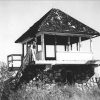 Forest Fire Lookouts
to
Forest Fire Lookouts
to
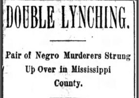
 Newport Fire of 1926
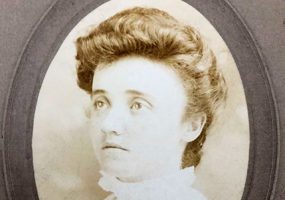
Jane Ellenbogen Stern was born in Little Rock (Pulaski County). Stern was a well-known conservationist and environmentalist from Arkansas. She dedicated herself to the preservation of the natural waterways and migratory bird habitats of the state, especially in eastern Arkansas. Although Stern chose to take a behind-the-scenes approach to conservation, she was presented with several awards for her efforts; among these were the Water Conservation Award (1971) by the Arkansas Wildlife Federation and the Carl R. Amason Conservation Award (1989) by the Arkansas Native Plant Society. Perhaps the most prestigious award she received was Conservationist of the Year, presented by the Arkansas Wildlife Federation.
The CALS Encyclopedia of Arkansas is a free, authoritative source of information about the rich history, geography, and culture of Arkansas. It is updated regularly to ensure the people of Arkansas have an accurate and accessible resource to explore our heritage. We invite you to browse our text entries and media galleries to learn more about the people, places, events, legends, and lore of the 25th state. We are continually adding new entries, photographs, maps, videos, quizzes, lesson plans, and more, so check back frequently to see what’s new.


Our overview page covers everything you would want to know about our beautiful state, including state symbols, demographics, and more!
See Overview


